There's one place, a huge creosote flat, where I like to go and camp, and just sit on my ass, doing nothing for three days, trying to become a human being again.
Anthropologists and architects babble on with notions of how space + story = place. This desert space of ours is awash in stories. Few places evoke such a strong feeling of wonder and awe as this parched chunk of land where we live.
I decided recently to take stock after all these years and see where we are: What's been happening out there? How are things?
What's the state of my Sonoran Desert?
The Sonoran Desert, one of the four great American deserts, covers more than 100,000 square miles. Because its geography is so varied, and its plant and animal life so diverse, it's tough to find a good definition of what the Sonoran Desert really is. It slops across parts of four states in two nations and even encloses part of an ocean. Its vegetation is relatively lush compared to other deserts.
A major characteristic is the presence of both leguminous trees (a fancy word for things like ironwood, palo verde, catclaw and mesquite) and big columnar cacti (another fancy word, this one for things like saguaro, organ pipe and cardón). Winters are mild, and there are two rainy seasons. Heavy, localized thunderstorms pummel the dry earth in the summer. Gentle, regional rains soak the desert in the winter.
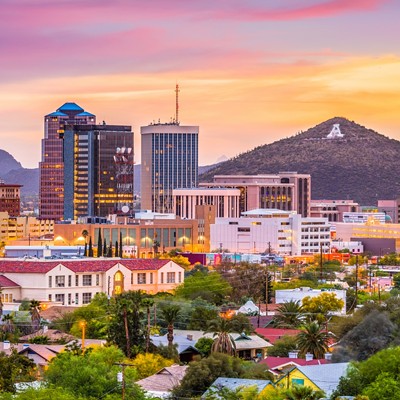
A scientist named Forrest Shreve was one of the first to take a stab at defining the Sonoran Desert early in the last century. He was a botanist, studying desert plants at the Carnegie Desert Botanical Lab on Tumamoc Hill, the big flat-topped hill next to "A" Mountain. The Desert Lab, founded in 1903, was where virtually all of the early research on the Sonoran Desert was done. Much of the young science of ecology had its beginnings on the hill.
Scientists have been doing groundbreaking research up there for decades. My own introduction to the ways of the Sonoran Desert began on Tumamoc one evening back in 1979, in a class taught by the famed paleoecologist Paul Martin. That first session, he handed around a stuffed pack rat and a fossilized giant ground sloth turd for everyone's enlightenment. The sorority girls in the class were horrified. The ocotillo became my designated "totem plant."
So I decided to pay a visit to Tumamoc Hill.
riving my little truck up the narrow, winding, one-lane road to the lab, it's apparent the place is under assault.
It was on the outskirts of town when it was first set aside as a scientific and ecological preserve more than 100 years ago. Today, Tucson has consumed it, sort of like a giant urban amoeba. The hill is now an island of Sonoran Desert surrounded by development. The lab itself is a National Historic Landmark, one of the most important historic sites in Southern Arizona. Tumamoc, among other things, hosts the longest continuously studied vegetation plots in the world.
The lab was how I remembered it. The walls made of dark-colored native stone give off a sense of deep history. It was cool up there, and quiet--a little too quiet. I walked up to the main building. Lynda Klasky, the friendly Desert Laboratory program coordinator, greeted me through the screen door. I told her I was looking for some of the researchers who worked up here, hoping they might talk with me about the Sonoran Desert.
They're all gone, she said.
I went down my list: Paul Martin--long retired. Ray Turner, retired. Joe McAuliffe, gone to the Desert Botanical Garden in Phoenix. Jan Bowers, retired and gone to the Owens Valley in California. Tony Burgess, off teaching at a university in Texas. Julio Betancourt ...
Wait. Julio's still around, she said. He's down at the UA's main campus.
So off I went, back down the hill. There were exactly two people at the lab that day, a far cry from years ago, when the place hummed with brilliant minds trying to figure out the mysteries of this enigmatic place where we live.
Julio Betancourt first came to the Sonoran Desert in 1976. He worked on an archaeological survey of the Santa Cruz River Park, a sort of Rio Nuevo-type project, only it was about 30 years ago. He left for a while, returning in 1979 to pursue graduate degrees in geosciences with a minor in ecology and evolutionary biology.
Betancourt is an environmental historian, someone who works to understand how climate has affected biological and physical systems in the past and attempts to apply that knowledge to the present. In other words, he studies how climate variability and climate change affect water and resources. It turns out his career choice was somewhat prescient.
He's a solid, earnest man. His hair and beard are going to gray. He chooses his words with the care of someone who takes this material very, very seriously. Betancourt is a man with a firm grasp of the big picture--it's his job. And it's obvious he cares about what's happening to the Sonoran Desert.
"It all comes back to history somehow," he says. He worked on Tumamoc for a long time, and inherited responsibility for the long-term vegetation-study plots. For a number of years, one of the most interesting questions up there was what was going on with saguaros. There seemed to be a gap in recruitment (new saguaros being born), and no one understood why. Were they dying off, or was something more complex going on? Turns out that saguaros may actually have what he calls "episodic establishment," where they may not have a spurt of successful reproduction for periods of up to 50 years or so--they only reproduce when conditions are just right.
This was exactly the kind of interesting ecological problem that scientists working on Tumamoc Hill studied. Ecology is about using the crescent wrench of science to take apart the world, then trying to understand how it all works.
But none of this really seems to matter now.
Betancourt paused, looked me in the eye, and said, "The biggest thing that's happening in the American deserts is these invasions by exotic grasses from Eurasia and the Mediterranean areas. And now we have the added problem of buffelgrass."
He continues. "Think back 20 or 30 years. The Sonoran Desert was basically fireproof. You could go out and pour gasoline on a palo verde, light it, and there were not enough fine fuels between the shrubs and the cacti to carry a fire."
But things are very different now.
Buffelgrass (Pennisetum ciliare) is a perennial, fire-adapted and fire-prone grass native to Africa that was first introduced to the United States in the 1930s. The idea was to create better forage for cattle: Slaughter the wolves, shoot the jaguars and then introduce buffelgrass, and you've got yourself cow heaven on Earth, went the thinking. Researchers tinkered with the grass across the American Southwest and Mexico until it really took off around 1980. By 1990, it was all over Southern Arizona and Sonora, and it continues its explosive march across the desert landscape.
(The Tucson Weekly published an alarming pair of articles about buffelgrass in April 1996 and March 2006. According to Betancourt, the ecological disaster that was predicted in those articles is now coming true.)
Buffelgrass absolutely loves fire. It invades an area; lightning or a careless cigarette sets it off, and it burns hot, killing all of the native Sonoran Desert plants that never adapted to fire. (Ponderosa pine forests are perfectly adapted to fire. Saguaro forests definitely are not. Forest fire = good. Desert fire = bad.) Two or three burn episodes like this, and you're left with something resembling an African savannah; the Sonoran Desert is gone for good. The grass is exponential in its growth, starting out slow when it first sneaks into an area, then quickly overwhelming everything in its path.
And it's all over the place now--truly vast areas of the Mexican state of Sonora might as well be African savannahs, a monocultural grassland where once (just 10, 20 or 30 years ago) stood the diverse cacti, trees and other plants we associate with the Sonoran Desert.
Betancourt told me that the situation is now so critical that a fire could conceivably start down in the desert, work its way up into the foothills, and burn on up into the forest in the Santa Catalinas. Or vice versa. The gap that traditionally separated the forest from the desert is being bridged by buffelgrass and is setting the stage for a massive, fiery conflagration on an unprecedented scale.
"We are in the middle of an emergency," he said, "yet we don't call it that. The fragmented land-management strategy that we have today is a recipe for failure. If we don't get on this now, today, none of the other problems will matter."
I later spoke with Christine McVie, a local community activist who has worked for years on Pima County's conservation plans. She said that if you want to see an example of a buffelgrass disaster waiting to happen, just go up to Kolb and Sabino Canyon roads, and you'll see exactly what Julio was talking about.
So I did.
There's a Rural/Metro Fire station there. Immediately next to it is a warning sign about buffelgrass. And next to the sign was a patch of dry buffelgrass. The patches continue along Kolb off and on, pretty much all the way up into the Catalinas. It's chilling once you understood the ramifications of what you're looking at: This stuff could eventually take out entire neighborhoods.
I knocked on the door of the fire station. "Hey," I asked, "do you know if that's buffelgrass over there, by that sign?" The fireman looked confused and said, "Uh no, I think that's a patch over there across the street." I looked at where he pointed at some other nondescript grass, definitely not buffelgrass. I asked him if they ever got involved in buffelgrass mitigation, helping to lower the fire hazard in the community. He looked at me like I was nuts, and said, "No, we're firefighters, not lawn workers." Then he closed the door. And locked it.
Time for a road trip.
I saddled up the truck and headed for Organ Pipe Cactus National Monument. Ed Abbey worked there--primo Sonoran Desert. I read all of his park ranger journals once. The most exciting thing that happened was he once found a pair of women's panties hanging in a tree.
Instead of going west across the Tohono O'odham Nation, I drove up Interstate 10. Passing by the Ironwood Forest National Monument, I could see the jagged ridge of Ragged Top to the west. The O'odham claim this is one of the places, along with Picacho Peak, "where the demons come out."
There's buffelgrass out there, too.
Almost 10 years ago, I played a tiny role in helping create the Ironwood Forest National Monument. Not long after, I fought off a billion-dollar power plant and a giant transmission line that some folks wanted to build right next to it. That case went all the way to the Arizona Supreme Court, and somehow, I won. I'm not an attorney--just very determined.
Further on, I swung west onto Interstate 8, and drove through the Sonoran Desert National Monument. Not long after Ironwood was created, I first proposed the Sonoran Desert National Monument as a means to protect the Sand Tank Mountains, a pristine area of the Sonoran Desert being relinquished by the Air Force. The place has one of the most spectacular saguaro forests anywhere in the Sonoran Desert. The original proposal grew to include almost a half-million acres of spectacular Sonoran Desert lands from near Casa Grande all the way to Gila Bend on both sides of Interstate 8, all to be protected by a national-monument designation. It was a glorious thing.
Now that area's got buffelgrass issues, too.
Lunch is always at Sofia's Mexican Food in Gila Bend. They seem to appreciate that I speak a little bad Spanish, and totally cracked up when I spilled my glass of horchata all over the place. Gotta keep the locals entertained.
Then, back on the road, I headed south across the Barry M. Goldwater Range, a huge swath of desert that ironically has been protected for years because the military keeps people out. In the Crater Range, a small jagged volcanic mountain range along both sides of the highway, I pulled over to read a sign. Apparently, folks in Ajo want to build a giant 230-kilovolt transmission line through here.
After passing some buffelgrass along the side of State Route 85, I finally arrived in Organ Pipe Cactus National Monument. I went to visit with Sue Rutman, a plant ecologist and botanist with the National Park Service.
Rutman came to the park in the fall of 1994, "before the border issues cropped up." She's been here long enough to get a sense of the big picture.
"I think invasive species as a whole might be symptoms of climate change," she told me.
There are a lot of strange, new things going on in the desert that we don't quite know what to make of. For example, she described a recent study showing that there are elevated levels of nitrogen oxide and sulfur dioxide appearing on the desert's ground surface, possibly due to air pollution. It's unknown at this time how this impacts things, but the added nitrogen could potentially change the balance in the desert ecosystem.
She explained how the leguminous plants (those ironwoods, mesquites and palo verdes mentioned before) have always controlled the nitrogen balance. If nitrogen becomes more readily available across the desert, I asked, could this be enough of a tipping point to kick off an infestation of invasive grasses like buffelgrass?
"Well," she said, "like it or not, we seem to unintentionally be doing the experiment."
Another big climate-related issue is the ongoing drought. In Organ Pipe, in the Cabeza Prieta National Wildlife Refuge and especially in the Pinacate volcanic field south of the border, she is seeing large areas of dead creosote and senita cactus, two of the most drought-tolerant desert species there are. No one knows for sure what's going on, but this is extraordinary, and it sure seems like climate is a factor. When creosote gets brown and crispy, you know something bad is happening.
Sue noted that in 2005, roughly 90 percent of the saguaros in the park failed to bloom. No one knows why. This set off a whole chain of impacts, because numerous insects, birds and other critters depend on saguaro fruit. There had also been a five-year period during which brittlebush had either not bloomed, or the bloom was severely depressed. And brittlebush is such an easygoing plant, it's used for ground restoration.
"There's a lot of weird stuff going on botanically," she noted.
So what about buffelgrass at Organ Pipe (OrPi in Park Service lingo)?
"Buffel is here to stay. Our goal is to manage buffel at OrPi. Our goal was to manage for small fires, but because we can no longer access certain areas of the park because of border issues, we have lost ground."
Finally, we talked about a rumor I'd heard: She verified that the Arizona Department of Transportation has determined State Route 85 through the park is a NAFTA corridor, and that long-term plans are afoot to widen the road to four lanes. Since roads, and especially big, well-traveled roads, are perfect vectors for invasives like buffelgrass, this does not bode well for OrPi.
It was getting late. I decided to make a quick run out to the northern end of the park to a place called Bates Well. It turns out that two-thirds of the park is and has been closed because of drug- and human-smuggling issues. Even the rangers aren't allowed to go out there without an armed law-enforcement escort. Rutman had told me that because of this, it was becoming difficult, if not impossible, for researchers to work in the park and gather the important data necessary to document and understand whatever changes are going on. Park staff are spending almost all of their time dealing with border issues. The road to Bates Well is open, because it goes out to the Cabeza Prieta National Wildlife Refuge, and there's supposed to be a Border Patrol outpost out there that I wanted to see.
Almost 20 miles of dirt road brought me to the Bates Well historic ranch site--except the site had been obscured. I hardly recognized it, except for the tattered old Bates Well sign.
There was now a Border Patrol outpost built on top of the historic site. Unbelievable. No one seemed to be around. There were three tan container units that were apparently sleeping quarters. A couple of patrol trucks. A bank of spotlights. A water truck. A fuel truck. Fuel was slopped around on the ground--not a good thing on a historic site, and, in fact, illegal. A trailer with a couple of quads. And, for some reason, an abandoned set of weights for working out.
A helicopter suddenly zipped out of the backcountry wilderness, zoomed over for a look at me, then continued on. The racket shattered the solitude.
The last time I was out here, the National Guard was also here, assisting the Border Patrol. The Park Service archaeologist at the time was showing me the damage the federal law-enforcement guys were doing to the park and its archaeological sites by driving off-road whenever they felt like it.
There were basically two kinds of vehicle tracks, all of which the feds blamed on smugglers. One kind of tracks went straight north. The other kind came from guys on quads, doing donuts out in the desert, sometimes on top of archaeological sites. I had to wonder: Did smugglers really have the time to do donuts out in the desert, or were bored former Kansas farm boys pretending they were in a giant off-road park? As we stood there looking at one of these damaged archaeological sites, a National Guard guy came up in a Chevy Blazer. Because we apparently didn't move our truck out of his way fast enough, he just drove off into the park, destroying a bunch of helpless creosote bushes, smiling and waving as he drove by.
With two-thirds of the park essentially not being monitored by the Park Service, who knows what's happening out there now?
Both Ironwood Forest National Monument and Sonoran Desert National Monument are being hammered by smugglers and law enforcement. At Ironwood, the ineffectual Bureau of Land Management failed to take steps to protect the northernmost Spanish visita in Arizona, a kind of small missionary outpost, located along one of the major smuggling routes out of Mexico and across the Tohono O'odham Nation. As a result, smugglers and law enforcement started driving over the site, destroying one of our most significant historic sites in Southern Arizona, a site that had literally sat intact for centuries. The BLM recently put boulders out there to direct traffic away from the site, but it was too little, too late.
The last time I was there, dozens of miles north of the border, I came across two completely shot-up pickups that had been involved in a running gun battle.
If there is any hope out there, any hope at all, it just might come from Carolyn Campbell and her Coalition for Sonoran Desert Protection. As one of the coalition's founders and the executive director, not to mention being a perennial optimist, she cajoled, arm-twisted, pleaded and coerced her way into making the Sonoran Desert Conservation Plan a reality. After 11 years, the plan is headed toward finalization.
This cutting-edge plan is something that has never been done on this scale anywhere in the United States. The coalition has created a truly regional, multispecies management plan to be implemented on a countywide level that addresses the question: How do we live in the Sonoran Desert without mucking everything up? They are actually trying to plan, to get ahead of the curve, to prevent bad things from happening.
Some things they can't control, like climate change. But the plan provides a mechanism for addressing issues that can be addressed in a collaborative, proactive manner. The public has bought into this approach, and through political pressure, Pima County government and other local communities have come on board as well.
With the coalition, the county and local residents working collaboratively and cooperatively, the fragmented land management that Julio Betancourt mentioned earlier might be overcome, and maybe, just maybe, there will be a chance to stop the buffelgrass plague.
The history of Arizona has always been urban and extractive. We say we "love" the desert, but we live in cities. We destroy the ground (cattle, copper, cotton, citrus, construction) to make money so we can vacation in other places, driving in large air-conditioned vehicles to avoid the heat. We drain the rivers and the aquifers and move the water in concrete-lined pipes and canals to places where it does not occur naturally. We carve giant corridors across the landscape to provide power and transportation and recreation. We bring in plants from other parts of the world, because the local ones don't do what we want. We build ugly, disposable homes that begin disintegrating in three years. We spray chemicals across almost every square inch of land, and if we miss an area, air pollution takes care of it. Then we wonder about the rise in cancer rates. We get upset when animals don't read signs or respect property boundaries.
But we don't ever consider the ramifications of our actions.
The Sonoran Desert as we know it is dying. The science is there; the facts are known--not all of them, but certainly enough of them to take action.
The desert our children will know is not our desert. Their desert will be one consisting of small museum pieces, parks and monuments where land managers fight a hopeless and never-ending battle to save tiny pieces of what's left. The rest will be, as David Quammen described in his 1998 Harper's essay, a "Planet of Weeds."
This is not a drill. This is not some left-wing environmental doomsday apocalyptic fantasy.
This is the real deal. Action is everything.